Clustered Village or Scattered Farmsteads? Reading Settlement Patterns on a County Map
Compare clustered villages and scattered farmsteads on a county map, then use a local map to judge which homes connect through lanes and settlement fringes.
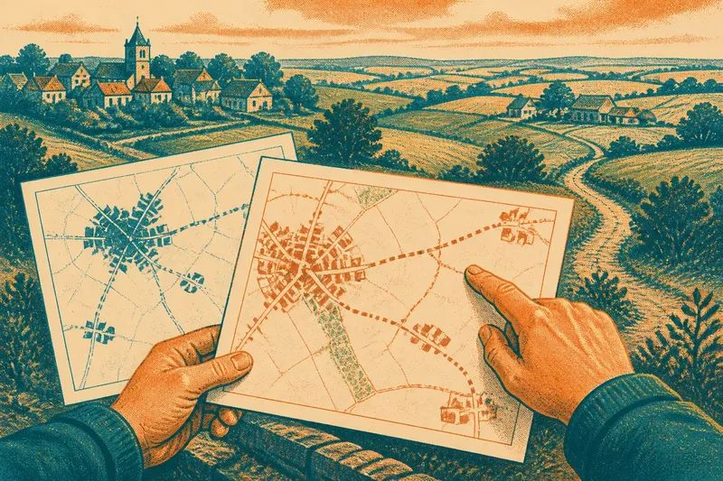
A clustered village and scattered farmsteads can look like separate worlds on a county map, even when a lane links them. Reading settlement patterns well means asking what the map shows about the route between buildings, not just counting the clusters and gaps.
Cluster and dispersion
A clustered settlement groups buildings close together. Its centre may include a church, green, shop or crossroads, but no single feature defines a village. The main clue is a recognisable concentration of homes and lanes.
Dispersed settlement places homes and working buildings farther apart. A farmhouse may stand beside its fields, with another dwelling along a lane or beyond a bend. A farmstead usually means the farm’s group of buildings, not only its house.
These terms describe arrangement, not age or character. A compact village can have farms at its edge, while a dispersed landscape can contain a small village at a crossroads. Read the labels as descriptions of a pattern, not fixed categories.
Routes between homes
Roads and tracks show how settlements connect. Several routes meeting near a village centre may lead towards neighbouring places; a narrow lane can serve individual homes beyond the built-up area. Lines on a map indicate possible movement, not how often people travel or which route they choose.
A map can also make the village edge look too sharp. A row of houses may appear detached from the centre although gardens, yards or other buildings fill the gap. Check whether the apparent break follows a real open space or simply reflects the map’s symbols and level of detail.
Trace the lanes beyond the last obvious group of buildings. A settlement may fade into a fringe rather than stop at a clear boundary.
Scale and symbols
Scale determines how much ground a map represents on the page. A county map covers a broad area, so it may show a village as one label or shaded patch and omit individual houses. A more detailed local map covers less territory but can show buildings, minor lanes and tracks.
Symbols affect the picture as well. A dot may mark a settlement without showing its footprint, while a building symbol may be enlarged to remain visible. Labels can hide nearby details. Check the legend before deciding whether a mark represents a house, a farm or a named place.
Say a county map shows a village as one dense patch and three farm symbols beyond it, with no minor lanes drawn. A local map of the same area shows a narrow lane leaving the village, passing two outlying homes and continuing to the farms. The expected result of comparing the maps is a connected fringe rather than a clean split between village and countryside; the local map still cannot establish how easy or frequent travel along that lane is.
Questions about settlement maps?
How can I tell a village from a hamlet?
Maps do not use a universal visual threshold, and local naming varies. Compare the building concentration and road connections, then treat the printed label as a clue rather than a complete definition.
Does a cluster mean services are nearby?
A compact pattern shows that buildings are close together, not which services operate there. Check mapped features or a current local source before drawing conclusions about shops, public transport or other facilities.
Why do farmsteads disappear at county scale?
Small buildings and minor tracks may be omitted to keep a broad map readable. Their absence from that map does not establish that the land is empty or without a route.
Can a map show whether a farm is isolated?
It can suggest distance from other homes and larger roads, but it cannot fully show visibility, terrain or the condition of a track. For questions about lived access, combine map clues with local knowledge.
Gaps and boundaries
The spaces between settlements are part of the pattern. A broad gap between villages may contain scattered homes or mostly open land. Compare building marks and routes, and bear in mind that a map with little detail cannot settle what lies between them.
Administrative boundaries need similar care. A parish or county line can cut across a cluster or separate a farm from the settlement it serves. Such borders describe governance, not necessarily the limits of a community.
For a focused comparison, check these features and let each observation guide the next map-reading decision:
- Observation: the map shows one dense group of buildings; if the question concerns a village centre, then inspect its lanes and central features, otherwise compare the group with outlying homes.
- Observation: several homes sit beside a single minor lane; if the lane is shown on a detailed map, then trace where it leads, otherwise do not infer that the homes lack a connection.
- Observation: a farm symbol stands apart from the nearest cluster; if the map is small-scale, then check a local map before calling it isolated, otherwise examine the intervening roads and terrain.
- Observation: a blank space separates two groups of buildings; if the map omits minor structures, then treat the gap as uncertain, otherwise compare the visible field, woodland and route symbols.
- Observation: a road appears to end at the village edge; if the map’s detail is limited, then check for a track or lane on a larger-scale map, otherwise note that the route may genuinely stop there.
- Observation: a boundary crosses a group of buildings; if the task is to understand community connections, then follow the roads across the line, otherwise use the boundary for the administrative question at hand.
When comparing a clustered village with scattered farmsteads, the county map is strongest at showing broad arrangement. A more detailed map can reveal the small routes that connect homes and turn an apparent divide into a settlement fringe.